


")
Panaji has been called by many names in its long history: Pahajani Khali, Panagim, Ponji, Pancha Yma Afsumgary, Nova Goa, Panjim, Panaji. Its recorded history goes back to early 12th century - an inscription of the Kadamba King Vijayaditya I, dated February 7, 1107, refers to the area as Pahajani Khali. Some believe that the name Panjim stems from Ponji or Pongys (literally, the ‘land that never gets flooded’) while still others interpret it as a variation of Pancha Yma Afsumgary or five wonderful castles where Ismail Adil Shah, the Sultan of Bijapur, and his wives lived. The Portuguese christened it Panjim, and in 1843, by a royal decree, when Panjim was elevated to the status of a city, it was renamed Nova Goa. In 1961, an independent Goa gave its capital a new name: Panaji.

Designed by the Jesuits of the College of St Paul in Old Goa, the bridge-cum-causeway that had 38 arches on the Panjim side was built on alluvial soil buttressed by trunks of the local zambo (jambo) tree, its superstructure made entirely of laterite stones. Nearly 400 years later, that causeway hasn’t crumbled; it still curls around Panjim like a necklace.
Plague and famine in Old Goa
If it weren’t for a relentless cholera outbreak, a cruel plague and a devastating famine in Old Goa, a swampy marshland lorded over by mosquitoes would not have turned into the capital of Goa.
Disease outbreak started devastating Old Goa - locals fled the town, officials abstained from office and the workers refused to step into the cursed streets. On December 1, 1759, the then Viceroy, Dom Manuel de Saldanha de Albuquerque, Count of Ega, shifted his residence from Panelim (near Old Goa) to the Adil Shah Fort in Panjim. The harem was levelled and the moat around the fort was filled up and turned into a road.
Old Goa was ravaged by disease and there was no option but to move the capital. Panjim was not the obvious choice, for a few years, officials toyed with the idea of Mormugao as the new capital. But that idea was shelved and Panjim was anointed as the future capital.
Planned city
The first plan of Panjim city was drawn up in 1776 and the survey of 1776, signed by the Infantry sergeant José Antas Machado was carried out for the clear purpose of getting to know the area better, so that a plan for Panjim could be drawn up. The draughtsman marked all edifices he considered important and to which the grid for the new plan should be adapted. But it took decades before the marshland got the capital makeover.
Called the Father of Panjim, the Viceroy, Dom Manuel de Portugal e Castro (1826-35) initiated frenzied construction work. Notices to appropriate land from the dwellers were posted on Casa da Administraçao, the Camara Municipal and the Panjim Church. Coconut groves were cleared, huts and houses razed to the ground, sand dunes from the old Goa Medical School and Hospital complex were levelled and large tracts of land were reclaimed.
To avoid flooding in this area, two long canals served as drainage and to make the traffic smooth, five large Roman arched culverts were laid over the canals.
The Fontainhas marshes were drained and the canal was built with roads on both sides. The fountains of ‘Phoenix’ at Fontainhas (Mala) and Boca da Vaca which provided potable water to the city were also constructed. Gardens were laid and construction began on a 5-kilometre internal road from Don Bosco School to Don Paula.
The barrier of Conceição Hill which separated Fontainhas from the central zone of the city was removed and the soil from the cutting of a 302-metre-long section through the ridge was used to fill up swampy areas in what is now the heart of Panjim.
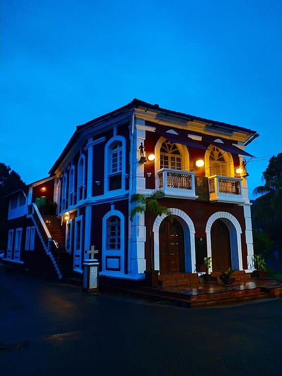 Panjim Inn in Fontainhas, Goa. (Photo by John Paul Jose via Wikimedia Commons 4.0)
In his 1851 book Goa and the Blue Mountains, this is how Richard Burton describes Panjim: “There are many respectable-looking houses, usually one story high, solidly constructed of stone and mortar, with roofs of red tile, and surrounded by large court-yards overgrown with cocoa-nut trees. Bungalows are at a discount; only the habitations of the poor consist solely of a ground floor. In general the walls are whitewashed—an operation performed regularly once a year, after the Monsoon rains; and the result is a most offensive glare. Upon the eminence behind the town is a small telegraph, and half-way down the hill, the Igreja (church) de Conceição, a plain and ill-built pile, as usual, beautifully situated.”
Glamorous turn
The last monarchical Governor, engineer Jose Maria de Sousa Horta e Costa (1907-1910) had an eye for aesthetics. During his tenure, some beautiful buildings came up and a four-carriage avenue with ornamental trees, starting from the Hotel Mandovi up to the Military Hospital near Kala Academy, added glamour to what was once a swampy marshland.
But Panjim was still not picture- and infrastructure-perfect. In 1922, the Panjim municipality invited engineer Luis A. de Maravilhas, Fiscal Director of Marmagoa Railway and Harbour, to improve the urban pattern and settlement zones of Panjim City.
Fontainhas, St Tome, Portais and Secretariat zones were excluded from the draft but the area beyond Church Square and covering the city’s entire western zone was planned by engineer Maravilhas. The plan was logical - a grid pattern of roads of more than average breadth and large footpaths with provision for tree plantation. Maravilhas incorporated the European drainage system and planned a modern boulevard.
Now, Panjim looks different from the original survey/plan of 1776, but the grid pattern, the boulevard, the causeway, the Adil Shah castle and a few beautiful buildings still narrate the story of Panjim that was once a bogland.
(Sources: Corporation of the City of Panaji; Panjim Between the Past & Modernity: Building the City of New Goa 1776-1921 by Alice Santiago Maria)
Discover the latest Business News, Sensex, and Nifty updates. Obtain Personal Finance insights, tax queries, and expert opinions on Moneycontrol or download the Moneycontrol App to stay updated!
Find the best of Al News in one place, specially curated for you every weekend.
Stay on top of the latest tech trends and biggest startup news.


