


Satellite images have shown the devastating impact of the powerful 7.7-magnitude earthquake that struck Myanmar on March 28, providing a clear view of the widespread destruction. The earthquake has claimed the lives of over 1,700 people, left more than 3,400 individuals missing, and displaced more than a million people across Myanmar and parts of neighboring Thailand.
Another 5.1 magnitude aftershock rattled the area Sunday afternoon, sending terrified screams through the streets before the relentless recovery efforts resumed.
Captured by Planet Labs and Maxar Technologies, the images reveal the full extent of the damage across central Myanmar, with buildings reduced to rubble and critical infrastructure heavily impacted. This tragedy has further strained the already fragile region, adding to the ongoing challenges faced by those living in the war-torn country.
Satellite images expose devastating impact of Myanmar earthquake
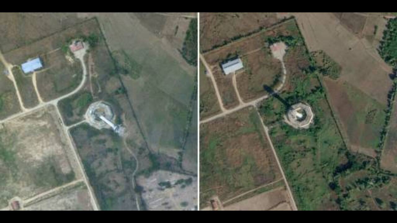 Collapsed control tower at Nay Pyi Taw Internatinal Airport in Naypyidaw, Myanmar (Credits: AFP)
This satellite image released by AFP shows the collapsed control tower at Nay Pyi Taw International Airport in Naypyidaw, Myanmar, after the March 27, 2025, earthquake and the same area on January 13, 2025.
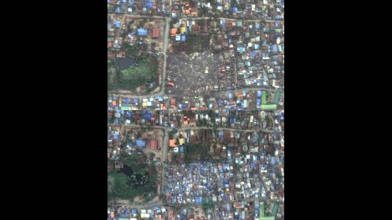 Images of building collapsed in Mandalay, Myanmar (Credits: AFP)
This image highlights the destruction in Mandalay, Myanmar, with collapsed shacks and buildings (top) following the March 27, 2025, earthquake, compared to the same area just days earlier on March 23 (bottom).
 Images of collapsed Inwa Bridge (Credits: AFP)
This image captures the devastation of the Inwa Bridge (top) over the Irrawaddy River near Mandalay, Myanmar, reduced to rubble after the March 27, 2025, earthquake. In stark contrast, the same bridge stands intact just days earlier on March 23 (bottom).
 Image of Mahamuni Pagoda and surrounding buildings collapsed (Credit: AFP)
The top image captures Mahamuni Pagoda and surrounding buildings the structures after their collapse following the March 27 earthquake, while the bottom image, taken on March 23, shows the area intact.
Earthquake strikes devastated Myanmar amid ongoing civil war
Prior to the earthquake, roughly 3.5 million people in Myanmar had already been displaced by the ongoing civil war between the military and opposition forces led by the deposed National Unity Government. This conflict erupted following the 2021 military coup, which ousted the democratically elected government of Aung San Suu Kyi.
Global humanitarian aid efforts
Several neighboring countries, including India, China, Thailand, Malaysia, Singapore, and Russia, have mobilized to provide humanitarian aid to Myanmar following the devastating earthquake.
Under "Operation Brahma," India swiftly deployed two C-17 military transport aircraft, which landed in Nay Pyi Taw late on Saturday. The aircraft carried essential equipment to set up a field hospital, with Indian personnel set to travel to Mandalay to establish a 60-bed emergency treatment center. This rapid response highlights India's commitment to assisting its neighbors during times of crisis.
Meanwhile, China has sent over 135 rescue workers, along with medical supplies and generators, and pledged $13.8 million in emergency aid. Chinese state media reported that at least 12 people were injured due to the tremors caused by the earthquake.
Discover the latest Business News, Sensex, and Nifty updates. Obtain Personal Finance insights, tax queries, and expert opinions on Moneycontrol or download the Moneycontrol App to stay updated!
Find the best of Al News in one place, specially curated for you every weekend.
Stay on top of the latest tech trends and biggest startup news.


