The Indian Army on August 31 said that it had thwarted an attempt by Chinese troops to unilaterally change the status quo at the Line of Actual Control (LAC) on the night of August 29-30.
Indian soldiers pre-empted People’s Liberation Army (PLA)’s activity on the southern bank of Pangong Tso and undertook measures to strengthen positions, the army said.
In a statement, the Indian Army said that Chinese troops had violated consensus by carrying out the “provocative military movements”.
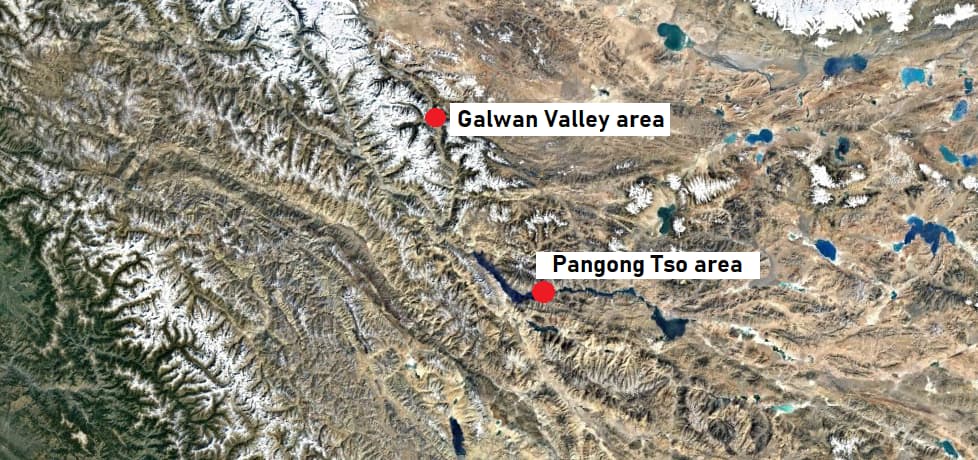
Tension between India and China at the LAC in eastern Ladakh region has been escalating since early May amid skirmishes and leading to a military build-up. The three main friction points were Hot Springs, the Galwan Valley and Pangong Tso.
However, they reached another level when a violent clash broke out in the Galwan Valley on June 15 in which 20 Indian Army personnel were killed. The Chinese side is also believed to have suffered casualties but it has not given details.
Confrontation point: Pangong TsoHowever, unlike the June 15 face-off, the latest confrontation happened on the southern bank of the Pangong lake, not the Galwan Valley. The expansive lake, sections of which are controlled by India and China, is south of the Galwan Valley. The Valley and the northern tip of the lake are over 80 kilometres away, as the crow flies.
Both sides are locked in a stand-off at Finger 4 of Pangong Tso along the LAC.
The ‘Finger area’ of Pangong Tso is made up of spurs that rise along the bank of the lake. According to India, the LAC is situated at Finger 8. The large swath of land between Finger 4 and 8 used to be patrolled by both sides before tensions escalated in May.
 Map not to scale. Only for representational purpose. (Satellite image courtesy: Landsat/Copernicus via Google Earth)
It was reported in early July that the Chinese military had inscribed a massive Mandarin signage and China’s map onto the ground they have occupied on the northern bank of Pangong Tso. The Mandarin signage appeared to say "China".
The ground inscriptions located between 'Finger 4' and 'Finger 5' along the lake, reportedly measure approximately 25 metres in breadth and 81 metres in length. These can also be spotted in satellite imagery, which Moneycontrol could not independently authenticate.
Discover the latest Business News, Sensex, and Nifty updates. Obtain Personal Finance insights, tax queries, and expert opinions on Moneycontrol or download the Moneycontrol App to stay updated!
Find the best of Al News in one place, specially curated for you every weekend.
Stay on top of the latest tech trends and biggest startup news.