


")
Heartache and devastation are the aftermaths of natural disasters. This was also the case with the recent earthquake in Myanmar. A powerful 7.7 magnitude earthquake hit on March 28, 2025. Thousands died and were injured, and it inflicted severe damage. Now, satellite images of the damage have been captured by India's space agency.
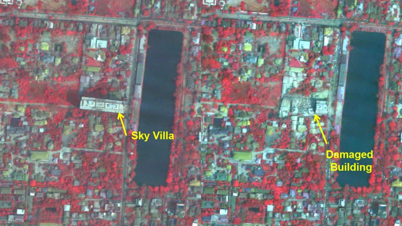 Sky Villa. (Image: ISRO)
Satellite Photos Show Pervasive Devastation
High-resolution images were released by the Indian Space Research Organization (ISRO). Cartosat-3 took the photographs 500 kilometers above the earth. The photos show the magnitude of Myanmar's destruction. A major bridge collapsed over the Irrawaddy River.
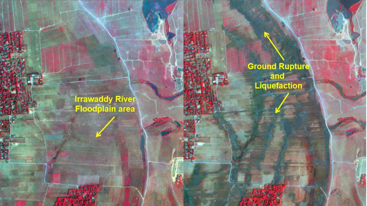 Irrawaddy River Floodplain (Image: ISRO)
Mandalay University suffered much destruction as well. Many buildings and highways were destroyed beyond repair.
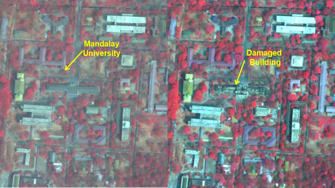 Mandalay University (Image: ISRO)
The second-largest city, Mandalay, was nearest to the epicenter of the quake. The confirmed death toll has reached more than 1,700. Heavy damage was also reported in neighboring Sagaing region. Iconic sites like the Ava Bridge and the Mahamuni Pagoda collapsed.
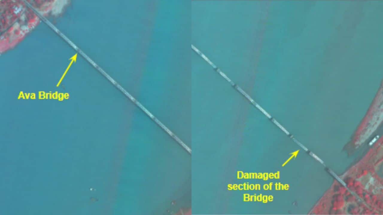 Ava Bridge (Image: ISRO)
International Aid and Emergency Response
The neighboring country of Thailand was also hit by the earthquake. The local government started emergency reaction operations. Myanmar's military government declared a state of emergency. Rescue teams are searching for survivors among the rubble. Over 2,900 people are said to have died, and thousands have been injured.
One of the earliest countries to render aid was India. Rescue teams were deployed to assist Myanmar in its recovery. As the country deals with the disaster, relief activities continue to be ongoing. The authorities are assessing the damage using the satellite images of ISRO.
Discover the latest Business News, Sensex, and Nifty updates. Obtain Personal Finance insights, tax queries, and expert opinions on Moneycontrol or download the Moneycontrol App to stay updated!
Find the best of Al News in one place, specially curated for you every weekend.
Stay on top of the latest tech trends and biggest startup news.


